 Whitetail Finder
 Read the pinch points before you leave the truck.
Whitetail Finder reads the terrain within 5 miles of any New Hampshire, Vermont or New York address and finds where the land narrows into lanes that can funnel deer travel: between water and steep ground, through gaps in ledges, along the edges where cover meets open fields. Each spot comes ranked, with the reasons it ranks. Each spot says whether it's on land listed as public, and which source lists it. Pro showsWith an invite, the map shows a listed public parking lot and the walk-in only where both stay on listed public land or public roads.
For New Hampshire, Vermont and New York deer hunters, wildlife watchers and photographers
Whitetail Finder checks a map against set criteria and shares waypoints where the terrain narrows into the kind of ground that can funnel deer travel. It reads the land only, not whether deer are there today. A spot is not permission to hunt, fish, enter or cross any land.
Beta testers
Sign in, or create a free account. Beta testers with an invite code get everything free.
Get the app
Whitetail Finder installs straight from this page to your phone's home screen. No app store needed. It opens full screen like any other app, and areas you've already opened still show up in the woods with no signal.
You're using the installed app. You're all set.
iPhone or iPad
- Open whitetailfinder.com in Safari.
- Tap the Share button at the bottom of the screen.
- Scroll down and tap Add to Home Screen, then Add.
Android
- Open whitetailfinder.com in Chrome.
- Tap the menu ⋮ at the top right.
- Tap Add to Home screen (or Install app), then Install.
Picking the spot is the hard part
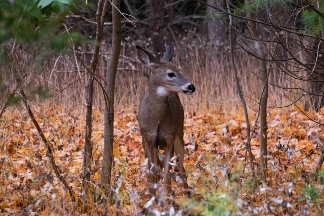
Most of us get a handful of days in the woods each season, whether we carry a bow, a rifle, binoculars or a camera. Everything else comes after one decision: where to start looking. In northern New England's big, rolling woods, that decision is harder than it looks.
It all looks like woods from the road
Miles of hardwoods and softwoods look the same from a truck window. Deer don't use it all evenly. Where water, ledges and steep slopes leave only a narrow easy way through, their travel bunches up.
Reading a topo map takes years
Spotting a funnel in contour lines is a skill most people learn slowly, one ridge at a time, and it's easy to miss the one that matters on a piece of land you've never walked.
Scouting eats the season
Walking unfamiliar ground to find one good crossing can cost the mornings you were saving to sit and watch it.
Getting in is half the battle
A great spot isn't much use if you can't legally get to it, and land that's open to walking or watching may not be open to hunting. You'd rather know that at home than at 5 a.m.
Sign is still the final word
Rubs, scrapes and trails tell you what the map can't. A good place to start looking saves you from checking everywhere, and a good sighting is a good day.
What Whitetail Finder shows you
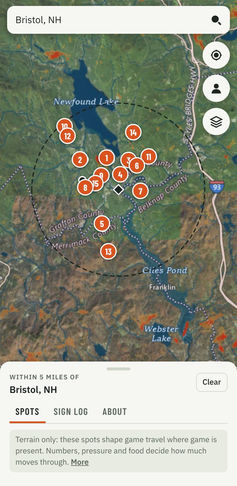
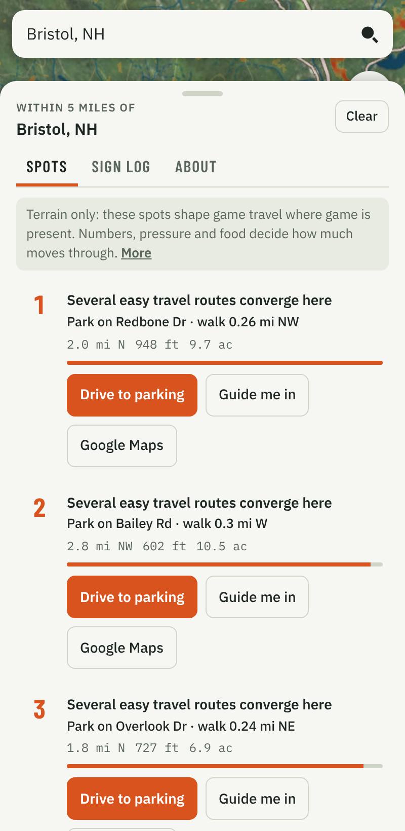
Search an address or tap your location. You get the spots within 5 miles, ranked, each one explained in plain English. A free account gets 5 searches with up to 3 public spots each; Starter searches without a limit and adds weather and solunar; Pro shows every spot, private land included; beta testers with an invite get every spot and every feature, free.
-
Where the land funnels deer
Travel corridors shaded around the place you search, and the spots where the easiest routes through the woods squeeze into a narrow lane because of the terrain itself.
-
Ranked, with the reasons
Each spot says why it ranks, how far it is from where you searched, its elevation and its size, so you can compare them before you go.
-
Public land, named; private land, marked
A spot counts as public only where a state, federal or town source lists the land as open to the public, and it says which source and as of when. With Pro, wFor beta testers, where a listed public lot or public road connects to the spot over listed public land, you get the lot, the walk-in and driving directions. Spots on private land are marked "Private Land · Permission may be required" and never get directions.
-
Guide me in (Pro)
A GPS arrow to spots with a public way in, so you can find them in the dark. A way in is not permission to hunt there: check the land's rules.
-
A sign log that works with no signal
Pin rubs, scrapes, trails, beds and photos you took, or that you checked and found nothing, and see how much of the sign lands in the corridors. Spots you looked at at home stay on your phone for the woods.
What it can't tell you
Whitetail Finder reads terrain: where the land steers deer travel. It can't see whether deer are there. How many deer live nearby, hunting pressure, food, bedding cover, weather and the rut decide that, and nothing replaces scouting. It doesn't show property lines or posted land, and public-land lists can be wrong or out of date, so always confirm where you can go, what the land allows, and respect landowners. Its land cover is from 2021, so recent logging won't show, and benches and ledges smaller than about 10 meters can be missed.
How we're checking it
We haven't proven it in the field yet. That's what this beta is for. About 15% of the ground falls inside the shaded corridors, so if the map is no better than chance, about 15% of the sign testers pin will land in them too. We're counting every rub, scrape and trail our beta testers log this fall, including the misses.
Know what you're looking at
Rules differ by state. Check the state's regulations and the land's own rules before you go, and identify any animal before taking it.
- New Hampshire: Hunting regulations
- Vermont: Hunting regulations
Free during the beta, by invitation
We're opening Whitetail Finder to a small group of New Hampshire, Vermont and New York deer hunters, wildlife watchers and photographers for the 2026 season. There's no charge while we test it. Use it, pin the sign you find, or that you found none, and tell us where it's right and where it's wrong.
Not ready to ask? Try it free: with a free account, 5 searches (up to 3 public spots each, and the corridor map within 2.5 miles of your search) and your own map of places and trails you record.
Starter or Pro
Starter: unlimited searches anywhere in New Hampshire, Vermont or New York, up to 3 public spots each, plus weather and solunar. Pro: every spot, private land included and clearly marked; listed parking, the walk-in and Guide me in on spots with a public way in; offline use and every other feature. Cancel anytime. Not for you? Get a full refund, no questions asked: within 7 days of your first payment on a monthly plan, or within 30 days on any other plan. One tap in your account. One refund per customer per app.
Whitetail Finder checks a map against set criteria and shares waypoints where the terrain narrows into the kind of ground that can funnel deer travel. It reads the land only, not whether deer are there today. A spot is not permission to hunt, fish, enter or cross any land.
Not yet proven in the field. Whitetail Finder reads terrain; it doesn't find or guarantee deer. We're checking it against beta testers' sign this season. Go only where you're allowed to. Payments are handled by Stripe. Terms